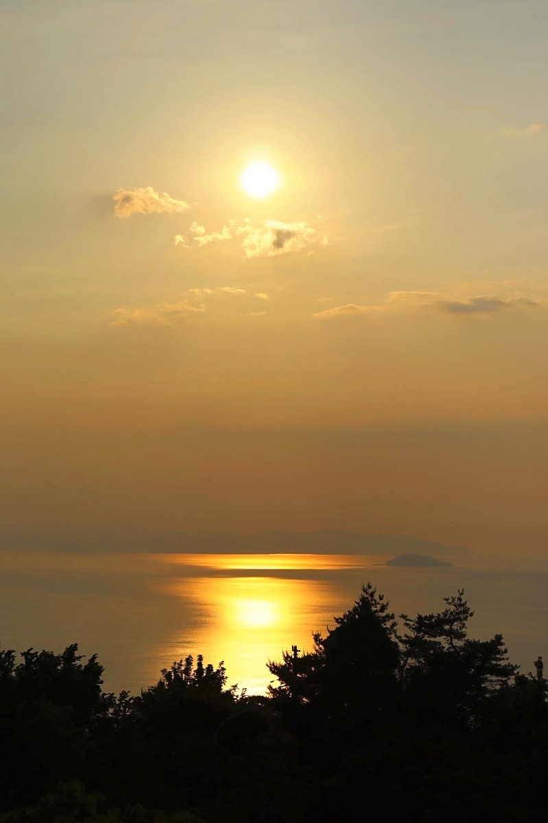
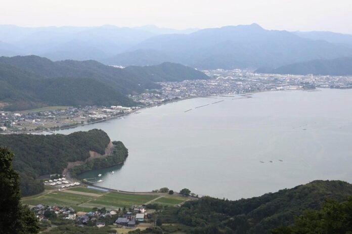
The cityscape of Obama, Fukui Prefecture, can be seen from the Angel Line. At dusk, the entire area has a faint pinkish glow.
11:30 JST, August 10, 2024
OBAMA, Fukui — The Sea of Japan, which faces Fukui Prefecture, is often seen as a rough sea. In Obama Bay — in the southern part of the prefecture — the sea is almost waveless.
I feel comfortable and at ease around Obama Bay, perhaps because the tranquility reminds me of the calm waters of the Inland Sea near my hometown in Hiroshima Prefecture.
The Angel Line is a scenic drive with panoramic views of Obama Bay and Wakasa Bay beyond. The road leads to Mt. Kusuyagadake (619 meters high) on the Uchitomi Peninsula.
The prefecture also has another tourist route, the Rainbow Line, which leads to a park with panoramic views of Mikatagoko (a group of five lakes). Both started as toll roads, but are now free to use.
One day in June I took a ride along the Angel Line.
Is that a raccoon?
The steep slopes and many bends of the Angel Line run through the forest. As I continued my journey, I slowly got the strong feeling that I was climbing a mountain.
Every now and then a gap opened in the forest, giving me a view of the peninsula, the ocean and villages. The buildings of the city in the distance became smaller and smaller as I rode on.
“Wow!” I exclaimed.
A small animal that looked like a raccoon suddenly darted across the road.
As I walked past parking lot #2 on my way to the top, I saw a monkey sitting on the right side of the road staring at me.
As I drove on, the hills became steeper. The car’s engine hummed as if it were straining, while in the other lane cars came down the hill one by one. Kyoto, Shiga, Toyota… Most had license plates from places outside of Fukui Prefecture, which made me realize once again that the road is a great ride.
About 15 minutes after passing parking lot #2, I reached parking lot #1: the end of the line.

Wakasa Bay is bathed in evening light.
The view from the observatory on top of Mount Kusuyagadake, a mountain surrounded by the sea, peninsula and mountains, was a picturesque panorama of blue and green.
Before my eyes stretched the cityscape of Obama, Obama Bay and Wakasa Bay. As I shifted my attention from one place to the other, the Tsunegami Peninsula came into view, accompanied by the outline of Cape Echizen in the distance.
I took a deep breath as a pleasant breeze blew over me, then looked back at the landscape. I saw the setting sun coloring Wakasa Bay red. In fact, the entire city was faintly colored reddish in the twilight, making for a picturesque scene.
Later I drove down the steep road, slowly descending. As I did so, I felt someone’s gaze on me. When I looked around, I saw two deer looking at me with sparkling eyes. I smiled softly at them as if to wish them good evening and then drove on home.
The sea and sky turned ultramarine blue. And Obama Bay remained calm as always.
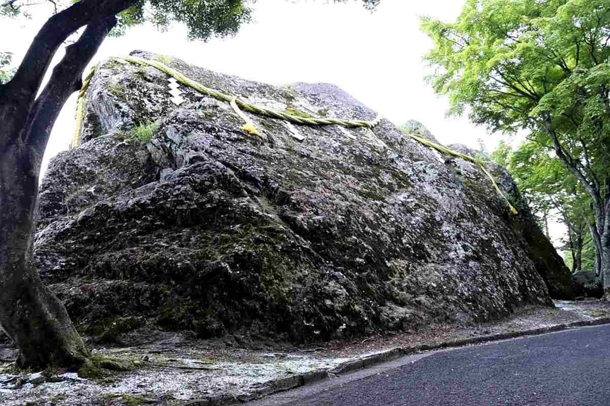
The huge sacred rock of the Deity
A huge rock decorated with a sacred straw rope stands out as you drive along the Angel Line. It is called “Okami Ishi” (Great Deity Rock).

Okami Ishi is decorated with a sacred straw rope.
The rock is an object of worship for Kusuya Shrine at the foot of Mt. Kusuyagadake. According to legend, the shrine’s deity once sat on the rock.
Mount Kusuyagadake is said to be a sacred mountain and probably owes its name to the shrine.
Why not pray to the sacred rock to keep your driveway safe?
Angel line and rainbow line
The Angel Line is about 10 kilometers long and is closed at night — from 19:00 to 07:00 — and in the winter — from December to March. The road was originally opened in 1972 as a toll road, but has been a free public road since 2002. “Angel Line” is the nickname chosen by the public. It is officially called the “Tomari-Obama Station Route”. The “Rainbow Line” is the nickname for the “Mikatagoko Rainbow Line Route”.


